The record-breaking warm weather is taking a break for the first blast of winter of the year this week.
“Even in an El Nino year you’re going to see moments where the non-typical El Nino weather can dominate, that’s certainly true in the next week to 10 days,” Armel Castellan, a meteorologist with Environment and Climate Change Canada told Black Press Media. “This is an interlude and we have to be ready for everything, as we know.”
Warm and dry winter so far, with the warmest December on record documented at the Victoria (Gonzales) station last month. The Gonzales station was 2.5 C above the norm for the monthly average as were temperatures at the Victoria (international airport) which made it the third-warmest in recorded history.
Comox also recorded its warmest December.
A special weather statement in effect says 'a wintry mix of weather is on its way'. Take time to:
— Saanich Emergency Program (@SaanichEP) January 8, 2024
❄️identify a winter weather buddy - check in with each other.
🔦Ensure your emergency kit is stocked - it will come in handy in a power outage.
Learn more: https://t.co/qykv9Y4WqS pic.twitter.com/n0kTnU0M11
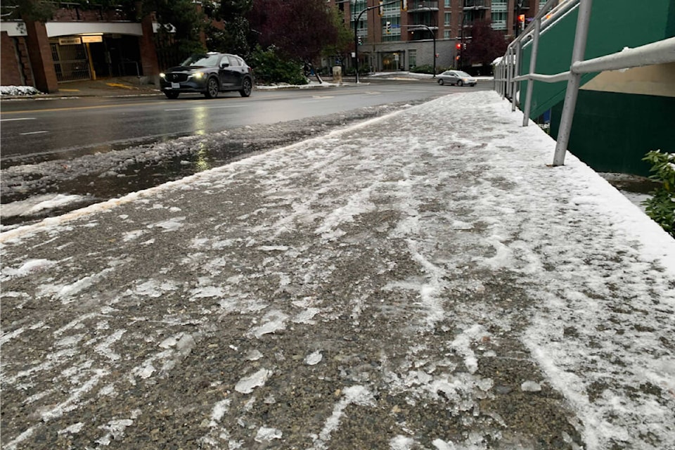
With snow on the Malahat portion of Highway 1 and other Island mountain passes Monday, followed by wind and warmer weather, the temperatures dip down again later in the week.
Overnight winds could cause mayhem for hydro, ferry travel and, on the southern tip of the Island, high tides.
Strong southwesterly winds of 60 gusting 80 km/h are expected late Monday, shifting to stronger westerly winds Tuesday morning. Those winds could guts to 100 km/h. Winds will become northwesterly Tuesday morning and continue at 80 km/h gusting to 100 through Tuesday.
Wind coming down the Juan de Fuca Strait could impact mid-morning high tides from Shirley and Sooke to Esquimalt and Dallas Road in Victoria.
“(It) could create some interesting conditions,” Castellan said. “It could make for the highest feeling tides of the year so far.”
Followed by a warmer Wednesday, things should get colder than usual Thursday (July 11).
“Temperatures are going to drop to much colder than usual, Castellan said Monday.
The “relatively rare” unseasonable lows could hit -6 C in Greater Victoria and -8 in Campbell River and bring chances of flurries.
People should be prepared for the unexpected. Unusual deep cold can mean burst pipes, the weather could include flurries, or pockets of full-blown snow.
“Those details will come hopefully as we get closer to the event itself,” he said.
Being ready for everything is a message also honed by PreparedBC. Winter weather conditions can quickly become dangerous with little or no warning and residents can protect themselves and others by staying hip to the different winter hazards and how to prepare.
Among the tips for staying safe is to find a winter buddy, particularly for anyone who lives alone or experiences mobility limitations in winter weather – then check in with each other when the cold hits. A buddy should be someone who can help with tasks such as shovelling snow and running errands.
A home can be prepared ahead to keep pipes from freezing plus insulation and weather stripping to help hold in heat when the power goes out.
Snowfall warnings & special weather statements issued for parts of BC.
— Prepared BC (@PreparedBC) January 8, 2024
Gather supplies (food, water & blankets) in case of a power outage ✔️
Avoid unnecessary travel ✔️
Follow @DriveBC & @TranBC for travel info & visit https://t.co/cgCLcTjt2Q for morehttps://t.co/iExEClCbhZ pic.twitter.com/xb4y41woCQ
Check emergency kits and grab-and-go bags; prepare for power outages; vehicle owners should have them winter-ready; get out the warm outdoor gear; and know where to get the latest information.
Environment and Climate Change Canada issues alerts at weather.gc.ca or call 1-833-794-3556 (English) or 1-833-586-3836 (French) for information.