Vancouver Island’s first snowfall of 2020 — ‘Snowmaggedon’, or the ‘Snowpocalypse’ — has passed.
Now the freeze-thaw cycle is wreaking havoc on our roads.
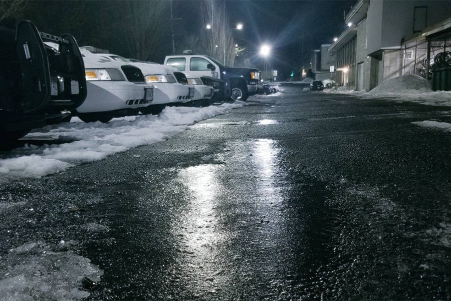
Drivers, cyclists and pedestrians are being warned of black ice on sidewalks and roadways after Thursday’s melt froze into ice overnight.
Drive BC warns of black ice on Highway 14, the Pat Bay Highway, Highway 1 and multiple other locations. Local police forces are also warning the public to be cautious.
RELATED: Winter storm warning lifted for most of southern Vancouver Island
RELATED: Snow-buried south Vancouver Island residents urged to stay home
With the worst of the snow over, Islanders should now be bracing for rain.
Roughly 20 - 30 milimetres of rain is expected to fall this weekend. Armel Castellan, meteorologist with Environment and Climate Change Canada said residents should prioritize clearing drainage pathways to prevent localized flooding.
“There’s an off chance the percipitation starts as a rain-snow mix, then shifts to rain for good. We’re definitely into the warmer stretch for the forseeable future – well into early February – we should not see another Arctic outflow situation,” Castellan said.
“As temperatures fluctuate above and below freezing over the next few days and with wind chill, black ice and slippery conditions can develop very quickly, flooding may also occur,” said Sidney public works manager Brian Robinson.
“Staff will continue to monitor weather and road conditions as usual and react accordingly. Potential for water main breaks are also a possibility with these types of weather conditions and staff are prepared to react as needed.”
And although some records were broken, while the snowfall was certainly notable, it wasn’t remarkable
“In terms of snow on the ground it’s not that exceptional,” Bobby Sekhon, meteorologist with Environment and Climate Change Canada said.
In terms of daily snowfall for Jan. 14, 2020, Sekhon said there were reports of 15 centimetres near Nanaimo. The daily snowfall record for the area is 19.1 centimetres in 1951.
“Daily records are to be taken with a grain of salt,” Sekhon said. “For example, for the 13th of January, the daily record is 38.6 centimetres from 1971. So, it just depends which day you fall that determines whether it’s record breaking or not.”
RELATED: 10 B.C. cities break temperature records in winter storm
RELATED: Greater Victoria snowfall breaks 2014 record
The dump of snow covered streets from Victoria to Campbell River for much of this week led to school and work and garbage collection service cancellations, and interruptions in BC transit service.
This morning, schools are open throughout the Island except on the Comox Valley, which drew the heaviest impact of the final stages of the storm.
The Ministry of Transportation and Infrastructure issued a travel advisory Wednesday urging motorists to avoid travel unless it was essential. Municipalities were also urging citizens to stay safe and take action.
“Thank you to all the residents who and are doing their part this morning by shovelling sidewalks. We count on you to keep these walkways clear for pedestrians as we continue to work to plough streets,” a post from the Town of Ladysmith said.
— with files from Black Press