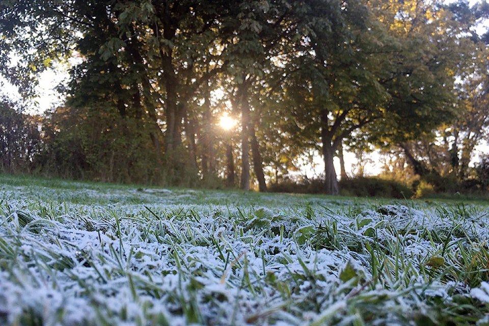
If you feel like it’s been an extra nippy start to October, it’s not in your imagination.
Unusually low temperatures were recorded at no less than five Vancouver Island locations yesterday.
Campbell River, Nanaimo, Port Hardy and Port Alberni joined Victoria in communities reaching for blankets and wool socks.
The chilly 0 C recorded at 5 a.m. at the Victoria International Airport Thursday morning is the coldest October temperature on record in a decade – since Thanksgiving, 2009.
And according to YYJ Weather Records, thanks to the early morning wind chill of -2.7 C, Thursday saw the most wind chill on an Oct. 10 since 1954.
🥇With a 5am windchill of -2.7, today is #Victoria-Airport's windchilliest Oct 10th since records began in 1954. pic.twitter.com/BxZYsSfdxO
— YYJ Weather Records (@YYJ_Weather) October 10, 2019
READ ALSO: Victoria weather smashes 120-year-old temperature record
According to Environment Canada meteorologist Armel Castellan, it’s the first time since 1966 that temperatures in Victoria have dipped below zero in the first two weeks of October.
“What’s amazing is how cold it is relative to this time of year,” he says. “This time of year it’s often 15 degree highs.”
The colder weather comes after a particularly warm and wet September, says Castellan, but October has always been a transition month – with the amount of precipitation typically doubling from September. But that doesn’t explain the 53-year record.
Castellan says that can be chalked up to a high pressure ridge, which not only prevents weather to move in off the ocean, but also prevents insulative clouds from forming, causing chilly but rain-free weather.
“Normally we have a strata cloud – a blanket cloud that keeps the heat blanketed in the area,” he says. But that ridge is also clearing the sky, “allowing for the heat from the day that has built up to radiate out - nothing is holding it back.”
Castellan calls it radiative loss, and says its cumulative – the longer the ridge is there, the colder it gets.
READ ALSO: Sunny skies ahead for Thursday, risk of frost later on
But that will change soon. As the ridge moves out, rain and warmer temperatures are anticipated. And Thanksgiving Monday is forecast a high of 15 C and a mix of sun and cloud.
And the cold days have no implication for weather to come. In fact, based on the information they have now, meteorologists are anticipating a warmer start to winter.
Temperatures plunged all across B.C. overnight, breaking a number of low temperature records – but meteorologists are expecting more seasonal weather ahead.
“We’ll flirt with a few records tonight, but gradually will see records climb closer to normal,” Environment Canada meteorologist Matt MacDonald told Black Press Media Thursday.
I’s an El Niño neutral year, Castellan says, and its too early to tell what we can expect on the West Coast.
One of the oldest records broken Wednesday was seen at the Vancouver International Airport where temperatures dropped to freezing, marking the coldest Oct. 10 in 123 years.
Meanwhile, the Bella Coola Airport dipped to -3.4 C, breaking a record of -3.3 C recorded in 1915.
A total of 41 cold temperatures have been broken in the past two days, including -10.3 C in Clinton on Wednesday, breaking a 2009 record, and -8.2 C in Smithers, smashing the old record set in 1959.
MacDonald said skies are expected to remain clear overnight Thursday, bringing more cold weather and possible records.
More records broken in B.C. Wednesday:
Abbotsford: -0.4 C (-0.1 C in 2008)
Campbell River: -5 C (-3 C in 1983)
Hope: -0.1 C (2.8 C in 2009)
Lytton: -2.3 C (1.7 C in 2009)
Nanaimo: -1.5 C (0 C in 1948)
Port Alberni: -2.7 C (-1.1 C in 1916)
Port Hardy: -1.8 C (-0.6 C in 1972)
Powell River: -1.4 C (-0.3 C in 2008)
— with a file from Ashley Wadhwani
nina.grossman@blackpress.ca
Follow us on Instagram
Like us on Facebook and follow us on Twitter.